Tarapoto Travel Guide


About Tarapoto
Tarapoto, known as the "City of Palms", was founded in 1782 under the name of Santa Cruz Motilones de Tarapoto. Capital of the province of San Martín and is located in the high rainforest zone, on shore of Shilcayo river, amid dense vegetation.
San Martín is a zone full of fertile valleys and rough terrain that is spread out between the Andean mesa and a small area of lower jungle. The first Spanish city in the jungle, named Santiago de los Ocho Valles de Moyobamba, was founded there in 1549. It served as a base for later colonization and departmental growth as well as the site where the first religious orders established themselves.
Tarapoto is a commercial hub in northern Peru, accelerated population growth, and unplanned urban growth, rural population is engaged in the cultivation of coffee, cacao, rice and export industries.
In the territories of San Martin developed ancient pre-Hispanic cultures as the Chachapoyas and then the Incas, leaving a legacy of important archaeological sites like the Gran Pajatén within Río Abiseo National Park, Cultural and Natural World Heritage Site (UNESCO).
From Tarapoto can enjoy many of its lagoons and waterfalls where the contact with nature and relaxation will make your visit a great experience. El Sauce lagoon, also known as the blue lagoon, is located only 35 kilometers south of the city and is itself a destination of lush landscapes and quiet waters, around which are located lodges that offer various programs to visit.
Contact with nature offers unique options for the observation of orchids and birds and a rich flora and fauna particular to the cloud forest zone and opportunities for adventure tourism such as white water rafting, jungle expeditions and treks.
The folklore in the area also offers a variety of expressions, crafts, festivals, fine dining, traditional food such as juanes, tacacho with cured meat, cocona and grape juices and exotic liquors. It is almost obligatory visit the native community of Lamas to appreciate their peculiar customs, dress and architecture, people of many myths.
The fastest way to get to Tarapoto is by air from Lima
Tarapoto City Overview
-
Location:
Located in the high jungle plateau to east of Andean Range, what is known as the selva alta (high jungle or cloud forest), 1,167.98 feet (356 m) above sea level.
-
Distances to Tarapoto:
-
Climate:
Semi-hot humid. Rainy season from December to April.
-
Population:
161,132 inhabitants
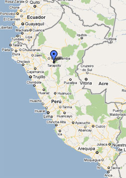
Maps of Tarapoto
|
|||
|
|||
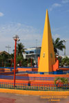
Tarapoto Main Square (Photo © J. Mazzotti) |
|||
|
|||
El Sauce Lagoon (Photo © J. Mazzotti) |
|||
|
|||
Ahuashiyacu Waterfalls |
|||
|
|||
Castle of Lamas (Photo © J. Mazzotti) |
|||
|
|||
Natives of Lamas (Photo © P. Godoy) |
|||
|
|||
Handicrafts of Tarapoto (Photo © J. Mazzotti) |
|||
|
|||
Torch Ginger (Photo © J. Mazzotti) |
|||


Tarapoto Guide
Tarapoto City: -the city of palms- Is a commercial hub in northern Peru, is fast-moving city, good fun and good food, the center-of-way to visit the attractions of the department of San Martín and Chachapoyas and Kuelap. It has a good basic hotel infrastructure in the city and resort on the outskirts of the city, tour operators who organize tours around the city. In the district of Morales are located fun nightclubs and discos, in the downtown are craft markets and local craft shops, shopping area, banks and ATM. It is the city where hardly find a taxi, public transport is based on motorbike taxis. Tarapoto has an airport with daily flights from Lima and Iquitos.
Around Tarapoto: Ahuashiyacu waterfalls and Regional Conservation Area Cordillera Escalera, Huacamillo waterfalls, El Sauce and Lago Lindo lagoons are places recommended for visits not less than 2 days. Chazuta town of potters and its archaeological sites, Polish petroglyphs are some of the most visited tourist attractions and are located near the city of Tarapoto, easily accessible by paved roads, places to nature encounter and eco-tourims
Lamas: Lamas Town is located on top of a hill about 1,000 feet high, 22 Km northwest of the city of Tarapoto, has steep streets and its main feature is available in terraces. The legend says that first level its lived by the Chancas (pre-hispanic culture) that arrived from the south Andean, the second to the mestizos and the third was used as a lookout. Today it retains the division between Indians, lamistas and mestizos, who celebrate their feast and patron saints separately. Although located in the jungle, the town has the structure of the Andean villages, probably the origin of its inhabitants. The Wayku neighborhood is inhabited by Indians descendants of the brave Chancas, who retain their traditional ancestral customs.
Alto Mayo Valley: This route is located northwest of the city of Tarapoto, on the Mayo River basin, where the cities of Moyobamba and Rioja are located, high rainforest, zone of scenic beauty, tropical climate, is an area of great variety of endemic flora and fauna, highlighting their orchids. In the Aguajal Renacal del Alto Mayo - Tingana is an area for intimate contact with nature. From Tarapoto this route you can visit in one day, but those looking to spend more of its attractions can stay in the cities of Moyobamba and Rioja.
Protected Natural Areas: In the department of San Martin is located the Rio Abiseo National Park, Cultural and Natural World Heritage Site (UNESCO). Cordillera Azul National Park, Alto Mayo Protected Forest, Cordillera Escalera Regional Conservation Area and the private conservation areas as Tambo Ilusión and Juningue. Areas to protect the rich biodiversity that correspond to the high rainforest zone (cloud forest), especially the endemic species.
Juanjuí: Located 140 Km south of Tarapoto on the river Huallaga. It offers basic and comfortable accommodation in the city, restaurants and entertainment centers. The route of cacao, a village walk from Alto del Sol with beautiful scenery. Breo's impressive waterfall, 20 Km south from the city of Juanjuí (40 minutes by car), you reach the town of Huicongo, from there go to the waterfalls 58 Km (5 hours by motor boat) . It is also possible to travel 80 miles on route Juanjuí - Dos de Mayo - waterfalls (three hours by speedboat). Located on the upper river basin Huayabamba on a rocky massif covered by primary forest vegetation typical of high forest. They have a waterfall of 140 meters and have four levels. The giant rocks over 4 feet high are covered by a thin carpet of algae and moss. The path that leads to the falls is ideal to observe ferns, giant epiphytes or "elephant ears", colorful orchids and hanging nests of oropendolas (páucares), typical birds of this area. Juanjuí is also one of the access Río Abiseo National Park and the Gran Pajatén through the checkpoint Churo.