Lake Titicaca |

Lake Titicaca |

Sunrise on Lake Titicaca |
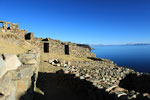
Sun Island - Bolivia |
Lake Titicaca |

Uro's Islands |
Lake Titicaca
It is an ideal place for the lovers of the ecological tourism, rural tourism and everyone who wants to visit the archaeological locations of old civilizations, everything in landscapes of unforgettable charm.
Its name, deeply significant in local mythology, derives from "Titi" Aymara for cat and "Caca" Quechua for The Sacred Rock on the Island of the Sun.
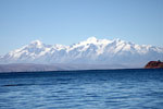
It is located on the Collao plateau. Constitutes the highest navigable lake in the world, 3,812 meters above sea level. It possesses an extension of 8,300 sq. Km, of which 4,966 sq. Km corresponds to Peru and 3,334 sq. Km to Bolivia. It measures 195 Km. length and 65 Km. width and it reaches until 304 m. depth. It presents numerous geographical accidents, 36 islands, some of those inhabited and with archaeological remains.
The south part denominated "Huiñaimarca" is separated from the lake by the "Estrecho de Tiquina" (Strait of Tiquina). It receives the waters of all rivers of the Collao plateau. The biggest quantity of water is received from rains, and it reaches difference of levels up to 2 m. The waters of the lake discharge by the Desaguadero River, but mostly it loses its waters because of the evaporation (95%). The average temperature of its waters is from 9°C to 12°C (48.2°F to 53.6 °F).
This lake is very important in Andean mythology since, according to legend, Manco Capac and Mama Ocllo, children of the sun god and founders of the Inca Empire, emerged from its waters.
The lake is very popular among tourists and scientists alike, who are amazed at the richness of its waters. It is a National Reserve and is home to numerous species of birds and water fowl, a dozen species of fish, a variety of mammals and seven amphibians, including a unique species of giant frog.
The famous scientific and expeditionary Jaques Cousteau carried out, in 1968, the biggest scientific investigation in the Titicaca.
The lake contains numerous islands whose inhabitants continue to live as their ancestors have in custom and tradition. The Uros an example of this; this people group lives on "floating islands" that they have artificially made entirely of totora reeds, and they navigate in their traditional boats also made out of totora reeds. Taquile, Suasi, and Amantaní are knows for their kindness of their residents, their ancestral skill in weaving, their pre-Columbian constructions, and lovely countryside.
The National Reserve of Titicaca (36,180 hectares) protects extensive stretches of totora reeds and various species of plants, animals and birds. It is a good place for bird watchers (endemic birs species)
Inside the lake different tourist destinations exist, among those we recommend the following because of their proximity to Puno's port:
- The floating islands of the Uros.
- The Taquile Island.
- The Amantani Island.
- Towns around Lake Titicaca
 LAKE TITICACA AND PUNO - PHOTO GALLERY.
- Puno City
- Andean Explorer Train
from Cuzco to Lake Titicaca - Lake Titicaca
- Sillustani Archaeological Site
- Pucará - Museum and Church
- San Juan Bautista Church
- Amantani Island
- Taquile Island
- Uros Islands
- Yavari Project
- People of Taquile Island
- Uros Islands - People
- Uros Islands - Reed boats and Houses
- Dances of Puno
- San Santiago Feast in Puno
- San Santiago Feast in Taquile Island
- Virgin of Candelaria Feast - Yellow
- Virgin of Candelaria Feast - Green
- Virgin of Candelaria Feast - Blue
- Virgin of Candelaria Feast - Red
BOLIVIAN AREA (NEXT TO PUNO) - PHOTO GALLERY.
 LAKE TITICACA AND PUNO TRAVEL GUIDE - SEE ALSO:
- Lake Titicaca & Puno Travel Guide
- Puno City
- Lake Titicaca
- Uros Islands
- Taquile and Amantani Islands
- Taquile Intangible Heritage